Understanding and Utilizing Polar Graph Coordinate Circular Grids
Introduction to Polar Graphs
Polar graphs, also known as circular or radial graphs, are a unique way of plotting data points using polar coordinates. Unlike the more common Cartesian coordinate system, which uses x and y axes, polar graphs use a radial distance from a central point (the pole) and an angle from a reference direction (the polar axis). This system is particularly useful for visualizing and analyzing data that has a natural circular or angular component, such as wind direction, sound waves, and even certain types of scientific and engineering data.
Characteristics of Polar Graph Coordinate Circular Grids
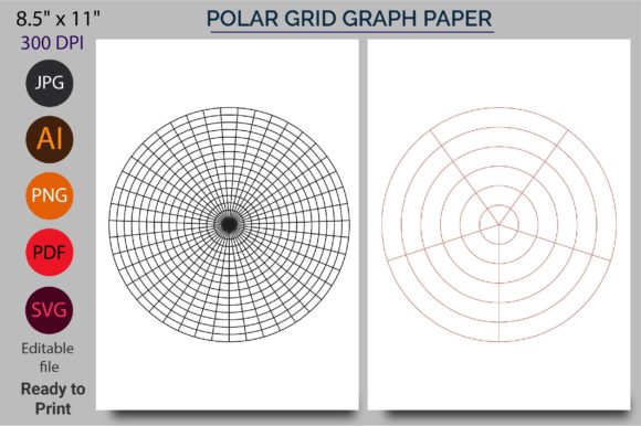
The polar graph coordinate circular grid is a specialized type of graph paper designed to facilitate the plotting of points in a polar coordinate system. These grids typically feature concentric circles and radial lines, which help in accurately measuring and marking both the radial distance and the angular position of each point. The grid's design allows for precise and clear visualization, making it an essential tool for anyone working with polar coordinates.
Variations and Formats
Polar graph coordinate circular grids come in various formats, including:
- Color variations: Different colors can be used to distinguish between different data sets or to enhance the visual appeal of the graph.
- Digital formats: These include Illustrator AI, PDF, PNG, JPG, and SVG files, which can be easily downloaded and printed or used in digital applications.
Practical Applications of Polar Graphs
The versatility of polar graph coordinate circular grids makes them suitable for a wide range of applications:
- Mandalas and Artistic Patterns: Artists and hobbyists use these grids to create intricate and symmetrical designs, such as mandalas and other geometric patterns.
- Graphic Design: Designers can utilize the grids to create visually appealing and balanced designs, especially those that require radial symmetry.
- Mathematical and Scientific Plotting: Researchers and students can plot complex functions and data sets, such as trigonometric functions, waveforms, and directional data.
Advantages of Using Polar Graph Coordinate Circular Grids
There are several advantages to using polar graph coordinate circular grids:
- Enhanced Visualization: The circular format provides a natural and intuitive way to visualize data that has a radial or angular component.
- Accuracy and Precision: The grid lines and markings ensure that data points are plotted accurately, reducing the risk of errors.
- Versatility: Suitable for a wide range of applications, from artistic to scientific, these grids can be used by professionals, educators, and hobbyists alike.
Considerations for Use
While polar graph coordinate circular grids offer many benefits, there are a few considerations to keep in mind:
- Data Type: Ensure that the data you are plotting is suitable for a polar coordinate system. Data that is linear or does not have a natural circular component may be better suited for a Cartesian coordinate system.
- Printing and Scaling: When printing, make sure to use high-quality settings to maintain the clarity of the grid lines. Scaling the grid appropriately for your specific needs is also important to ensure that the data is clearly visible.
- Software Compatibility: If using digital formats, check that the file types (AI, PDF, PNG, JPG, SVG) are compatible with the software you are using.
Conclusion
Polar graph coordinate circular grids are a powerful and versatile tool for anyone who needs to plot and analyze data in a polar coordinate system. Whether you are an artist, designer, researcher, or student, these grids provide a practical and visually appealing way to work with circular and angular data. By understanding their characteristics and applications, you can effectively leverage these grids to enhance your projects and achieve more accurate and visually appealing results.